If you’re looking for a beautiful coastal walk in the North York Moors then head of to the delightful Runswick Bay. The circular walk to Kettleness from Runswick Bay is just the perfect day out. It’s a great way to enjoy the best that the North Yorkshire Coastline has to offer.
There are two enjoyable walk options:
- Runswick to Kettleness Circular – 5.4 miles
- The longer coastal circular walk with lovely views towards Whitby – 9 Miles
Runswick Bay North York Moors
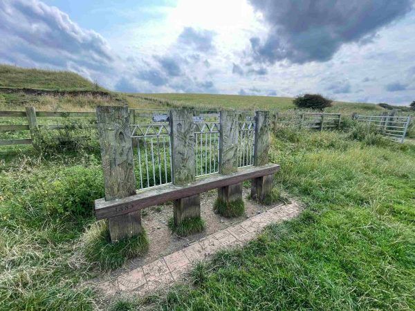
Setting Off from Runswick Bay
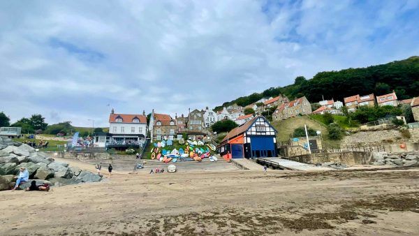
Parking can be a little awkward as the smaller beach side car park at the foot of steep hill is often full. If so, park at the larger car park at the top and walk down to the Tides Coffee Bar & Beach Shop which has pride of place set just above this popular beach and slipway. Grab a coffee or ice cream and take in the views before heading off.
From the picture perfect setting of Runswick Bay start by strolling along the sandy beach heading south west and towards Whitby. Keep an eye out for any jet rock stone, fossils and ammonites which appear on the beach after a recent rockfalls. Also checkout for the tides which can come sweeping in fast.
Runswick Bay to Kettleness – Heading Up from Hob Hole Caves
Join The Cleveland Way
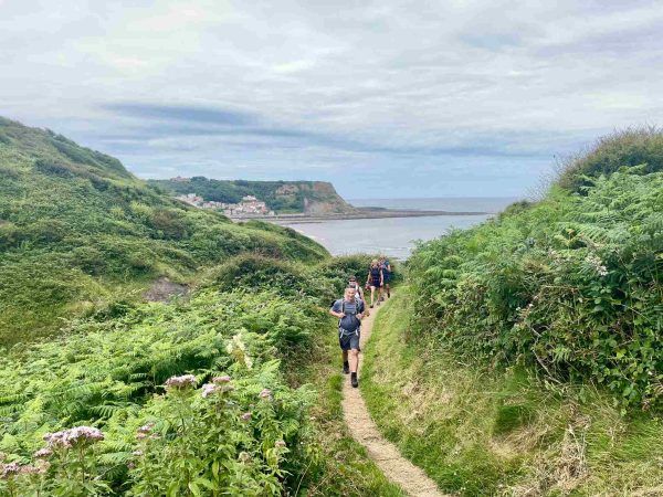
Just beyond the delightfully named Hob Hole Caves there is small ravine and stream. From here take the steep steps which take you up to the top of the cliffs, high up and joining coastal path and the long distance hiking trail Cleveland Way (109 mile walking route from Helmsley to Filey Brigg) with wide open fields and superb elevated coastal views.
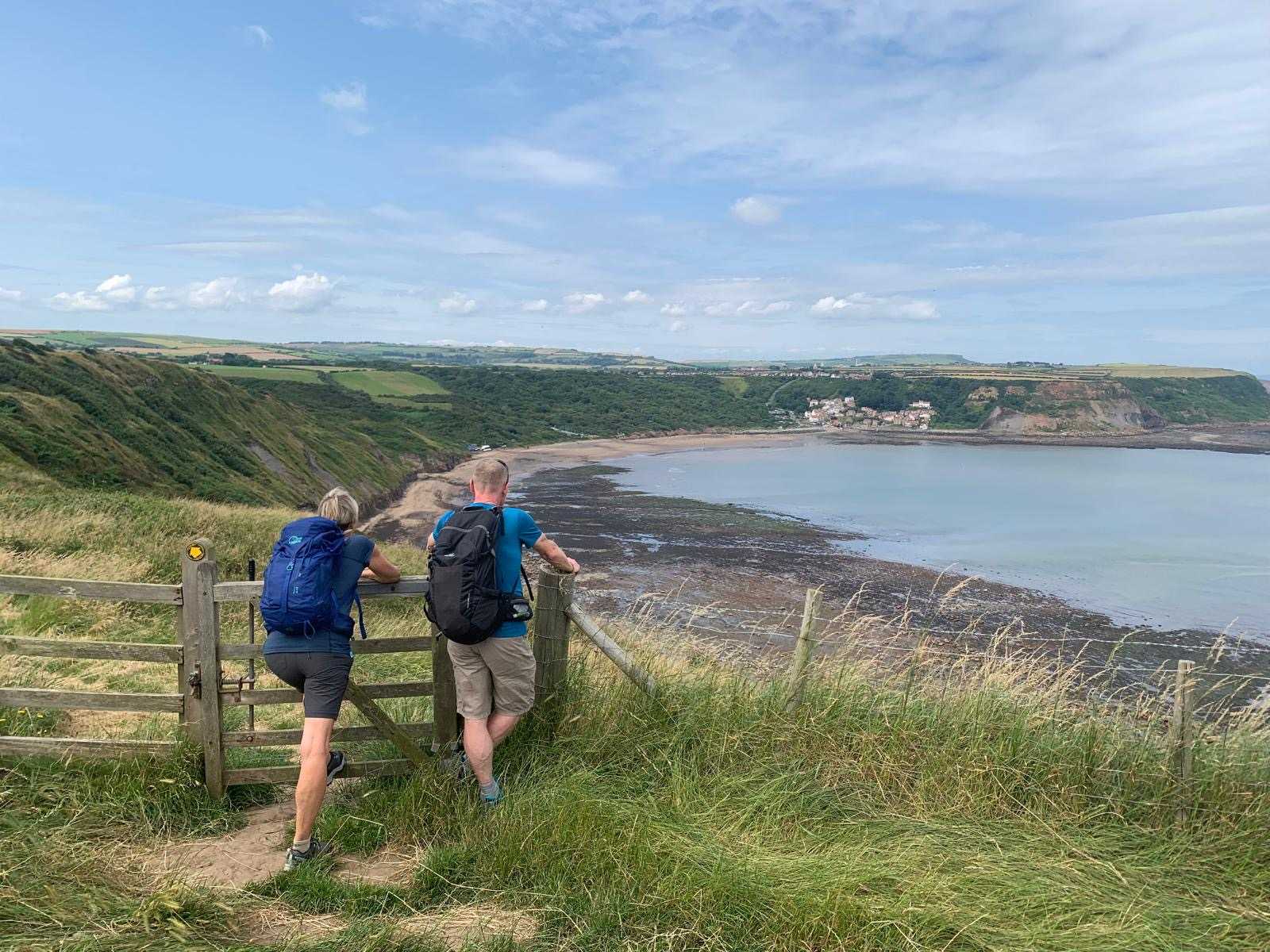
The well marked trail takes you along the clifftops, there are some interesting rock formations below. Take a look back over your shoulder and enjoy the splendid view back across Runswick Bay. In about a mile or so you will reach the tiny hamlet of Kettleness. There is the old Kettleness station here too which can be seen in its entirety on the way back.
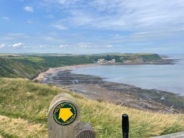
View across Runswick Bay – North York Moors
Should We Take the Shorter or Longer Route?
There is a shorter circular version of the walk (5.5 miles) where you can loop back to Runswick Bay along the old railway on the original Loftus to Whitby railway line, which was opened in 1883, but closed in 1958 due to its proximity to the cliff edge and subsequent erosion difficulties in maintaining it.
To continue to enjoy the longer version of this lovely coastal walk (9 miles) then keep left at Kettelness and stay on the Cleveland Way and follow the enjoyable headland around. Fascinating rock formations can be seen at low tide below the cliffs with great names like Scab Nab, Fillet Tail, and Keldhowe Steel. The old disused railway tunnel runs adjacent to the pathway for a section until you reach Tellgreen Hill.
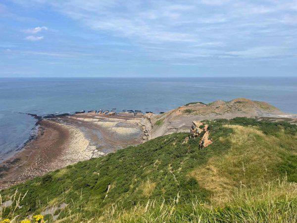
Rock Formations of North York Moors Coastline
Picnic or Pub Stop? Tough Choice!
It is time turn inland here on a new footpath signposted off the Cleveland Way. But, before you do so just take a short detour for 200 yards or so around the headland. If you do you will be rewarded with lovely views towards Whitby Bay and the mystical old Whitby Abbey ruins visible on the headland and silhouetted on the horizon. A lovely spot for picnic and flask of tea if you have brought one and watch the gulls swooping and perching impossibly on the cliff face.
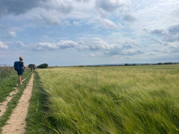
Crossing the Barley Fields
After a short section turn right again towards Goldsborough where the Fox & Hounds Pub can be found. This is another lunch spot or pit stop if you have not taken a picnic with you. Walking through the tiny hamlet, take the marked footpath on the right just past Raws Farm. We spotted a few large highland cattle safely behind a hefty gate in the farmyard. The footpath heads down Scratch Alley and past the old grassy foundations and remain of old Roman Signal Tower. Before arriving back at the village Kettleness.
View this post on Instagram
You Have Arrived at Kettleness Station
The route the turns past the old perfectly preserved and impressive Kettleness Station which still looks as though it is still awaiting the arrival of a steam train. The old railway line now takes you on your way back towards Runswick. This will follow the old track bed, and relics of the original coastal railway line, passing the old North Eastern Railway bridges and railway cuttings.
Part of the Old Railway Line
Continue along on the railway line for 2.5 miles passing a brick-built house called ‘Ellerby Crossing’ until you reach Low House, then turn right down Cloverdale Lane back towards the bay. Initially a track it soon becomes a path which descends down to the beach. Turn left and retrace your route back to Runswick Bay where the village is worth exploring.
Note; If you have parked at the cliff top car park, stay on the old railway line continue ahead along the old railway when you reach Low House. Reaching the road, then turn right back to the start at Runswick Bank Top.
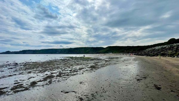
Runswick Bay – At Low Tide
Feet Up With a Pint of Beer
After an enjoyable walk along the spectacular North York Moors coastline, what better than to grab a well deserved locally brewed beer or glass of wine. Rest up after a 9 mile walk than at the Royal Hotel perched up high overlooking the sweeping bay, sandy beach beneath and the cliffs beyond.
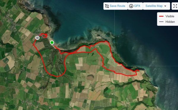
Runswick Bay to Kettleness Walk GPS Map
Walk Details:
Start: Runswick Bay Car Park, North Yorkshire, TS13 5HT
Getting there: Road – car park is signed from Cliffemount Hotel at Runswick Bank Top (signed as ‘Runswick’ from A174 Whitby-Loftus road). It is approximatley 33 miles, 50 minutes drive from Harome and our Helmsley Hideaway to Runswick Bay across the North York Moors National Park.
Bus – Service 5 (getdown.org.uk), Whitby-Loftus
Walk – 9 miles, moderate difficulty
Walk details: Right along beach. In ½ mile, just past Hob Holes caves, up rock, then wooden steps to cliff top. Follow CW for 2¾ miles. At Tellgreen Hill headland, right inland at ‘Lythe’ fingerpost. In 150m, yellow arrow / YA points ahead, but go right here to Overdale Farm drive, ahead to road. Right to Goldsborough. Follow ‘Kettleness’; in 50m, right (‘footpath’) through farmyard; on through gate (YA) down green lane. Through gate, half left via Roman lookout tower mound to shed in field corner. Over stile (YA); down to old chapel; over 2 stiles to road; right into Kettleness.
Left along old railway track for 2½ miles. Beside Low House, right off railway on track back down to Runswick beach; left to Runswick Bay.
Lunch: Royal Hotel or Tides Coffee Bar, Runswick Bay.
Useful Links and More Information:
- Walk Britian – Runswick Bay & Kettleness Circular, North York Moors Walk
- The Whitby Guide – Runswick to Kettleness Circular – short walk version
- Walking the Spectacular Views at Sutton Bank National Park
- Adventures in the North York Moors – A Rambling Walk, Spot of Sightseeing & Lovely Pub Dinner
- Helmsley Castle, Duncombe Park & Fairy Steps Circular Walk
- Lovely Local Walks around Harome – Explore the Countryside
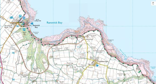
OSMaps – Runswick Kettleness Map & Route